Geo Map from Scientific Research

CC-BY
20
Views
0
Likes
Citation
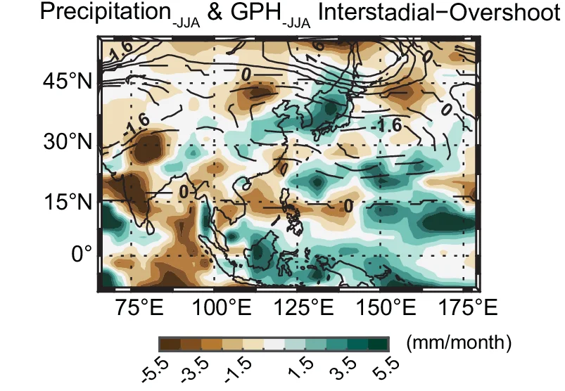
same as ( a ) but for the differences between long and short interstadials (Interstadial minus Overshoot phases). The intervals between each line correspond to 8/15.
Related Plots
Browse by Category
Popular Collections
Discover More Scientific Plots
Browse thousands of high-quality scientific visualizations from open-access research